
World Maps, Historical Maps, Cultural, Topographical & Other Maps
Table of Contents
There are lots of different types of maps besides just world maps. Technology has improved the accuracy and availability of information to put on maps, as well as usage.
Maps are tools for depicting the geographic distribution of information. While many people think of world maps showing oceans, continents, and country borders, there are many different types of maps that are used and that can be created.
In addition to world maps, other types of maps include topographical maps, geological maps, nautical maps, cultural and historical maps, political maps, and population maps. There are also very specialized maps that can replace graphs or charts to depict many different kinds of information.
World Maps
Maps of the world are usually depicted on a flat piece of paper that folds out in various sizes. Wall maps and floor maps can be very large and very detailed. Most world maps are oriented with the north on top, south on the bottom of the map.
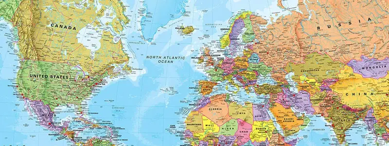
North Americans have long portrayed the Americas in the center of the map, cutting Asia’s huge landmass in half on the edges of the map. Some cartographers have designed world maps with south on top of the map, north to the bottom. Yet others have used the Pacific Ocean to be the split for the map edges.
Topographic Maps
Maps that show the relationship of geographic features to one another are called topographic maps. Some of the information that topographic maps can depict are:
- bathymetric (depth of water) information
- details on the contours of the earth
- altitudes
- land surveys
- underground mines and caves
- coastal features
- geographical surface features such as rivers, lakes, and canals
- the relationship of man-made structures such as buildings and roads
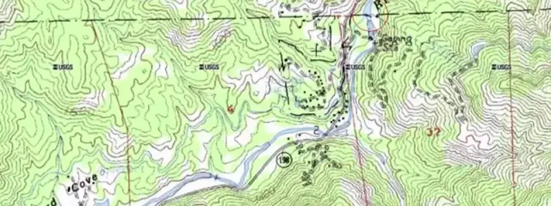
Topographic maps can be used by city planners, architects, construction companies, investors, travelers, airplane pilots, sailors, anglers, mountaineers, bikers, campers, naturalists, hikers, and other outdoor sportsmen.
Nautical Charts are a Type of Map
The National Oceanic and Atmospheric Administration, or NOAA, is a government agency that proclaims itself the “Nation’s Chartmaker.” NOAA’s Office of Coast Survey makes the nautical charts that are used by navigators such as pilots and mariners.
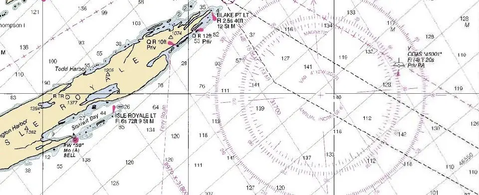
A nautical chart is a special type of map that includes more detailed information than most maps to help plan or chart a course while at sea. NOAA carefully explains the differences between static maps and working, nautical charts.
Cultural and Historical Maps
These types of maps include historical data at a glance, cultural dispersion, and historical perceptions of geography. There are many types of cultural and historical maps, especially found in textbooks.
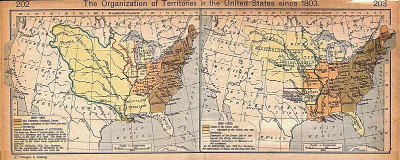
The earth is a dynamic planet, both with its human systems, and geologically. Some historical maps show what was perceived to be the geography of the planet at the time. Other historical maps depict historical events, such as world wars, migrations of peoples, and changing boundaries of countries.
Geological Maps
The geology of the planet can be depicted in maps. Geology maps can show the types of rocks in a region, topographical information, and denote movement over time of the tectonic plates that cover the surface of the earth.
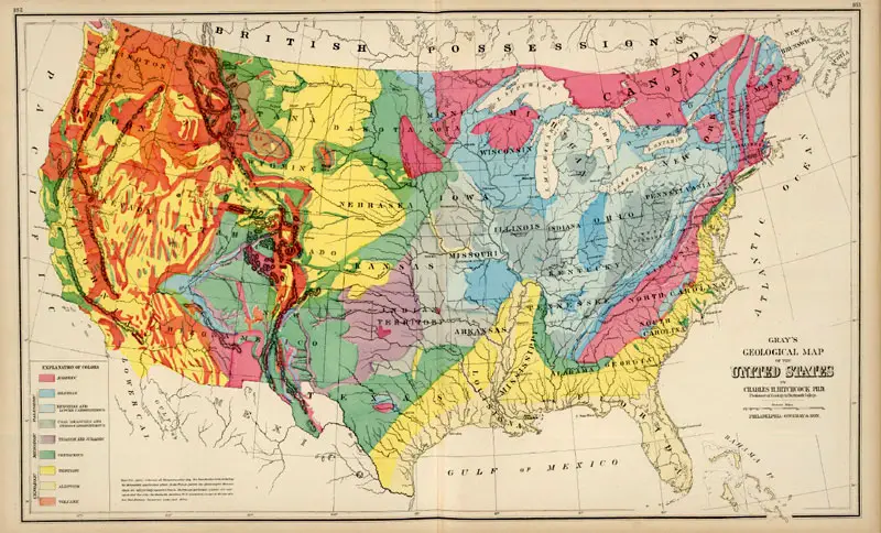
Geological maps can be used by geography students, as well as geologists, city planners, architects, historians, and more. These types of maps can help show patterns in the world’s earthquakes and other geological activities.
Political Maps
Maps that show the boundaries of countries are called political maps. Other types of political maps include voting districts; historical maps of empires; maps of states, departments, or provinces; regional maps showing types of governments; and maps of imperialism showing overseas territories.
Political maps can be used in the geography classroom, in campaign planning, for wartime strategy, as well as in the history or political science classrooms.
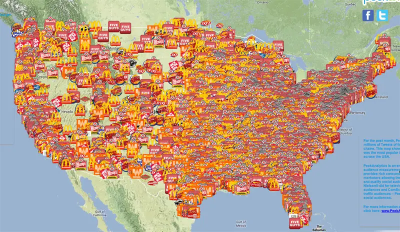
Other Types of Specialized Maps
Climatic data is shown on weather maps; population maps show the number of people in geographic areas, or can show other types of populations such as animals and plants; economic maps show industries and other economic information of regions, and thematic maps can depict the geographical relationship to any theme the cartographer wishes to convey.
Technology has vastly impacted the creation of maps as well as the use of maps. Technology has improved the accuracy and detail of maps. Modern technology has increased the types of maps that can be made, for example, nautical maps with accurate details of the ocean floors.
Using different types of maps can enhance the learning of a region, and can appeal to different types of learning styles. Maps can give a more comprehensive picture of a geographical region or area.
Resources:
The United States Geological Survey explains topographic map symbols in a free, online booklet on its website.
Most City and County Chambers of Commerce offer free local maps to the general public.
Google Earth. This is an interactive map available through Google as a free download. This map shows satellite pictures of every place on earth, with amazing capabilities to zoom in closely.